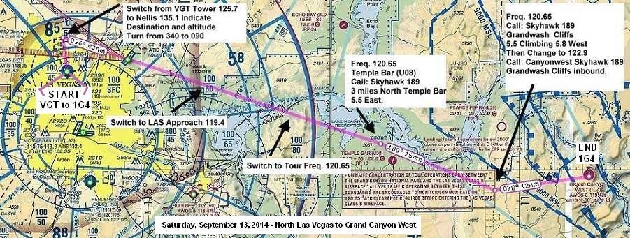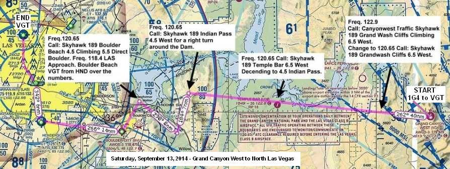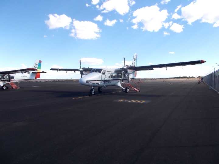
A couple
of Scenic Airliner - Twin Otter Vistaliners.
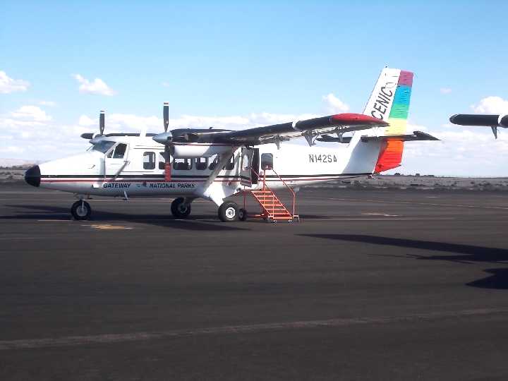
Scenic Airlines - De Havilland Canada DHC-6-300 Twin Otter Vistaliner
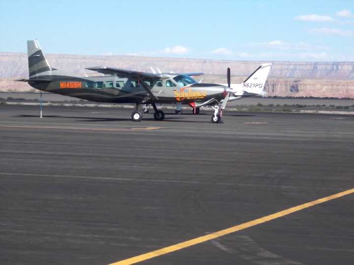
Walking
the ramp back to our plane and looking at Sundance's Cessna Caravan (single-turboprop) (C208/G)
.
Piper Navajo Chieftain PA-31-350 parked next to it.
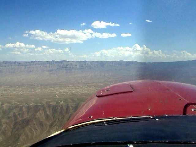
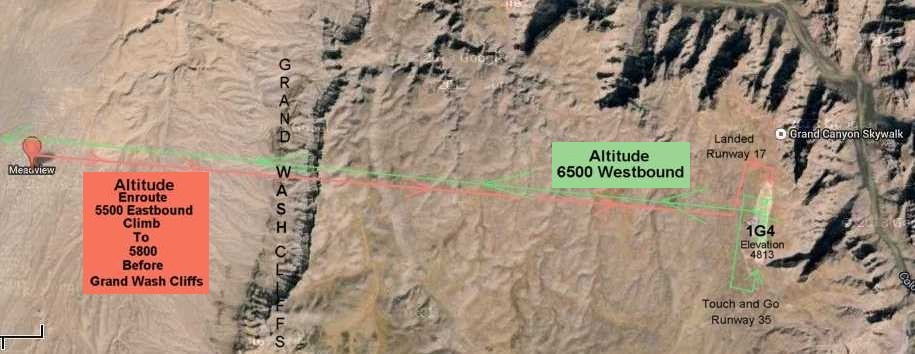
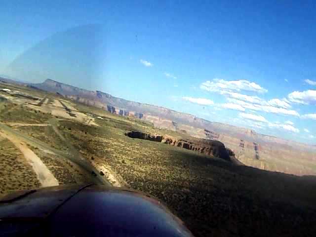
This is an
extracted still image from a video clip flying eastward to the Grand Canyon West
Airport, approaching
Meadview straight ahead. We were at an altitude
of 5,500 feet. Meadview is a fairly recently developed retirement community.
You can see the
increased terrain elevation of "Grand Wash Cliffs" beyond
"Meadview".
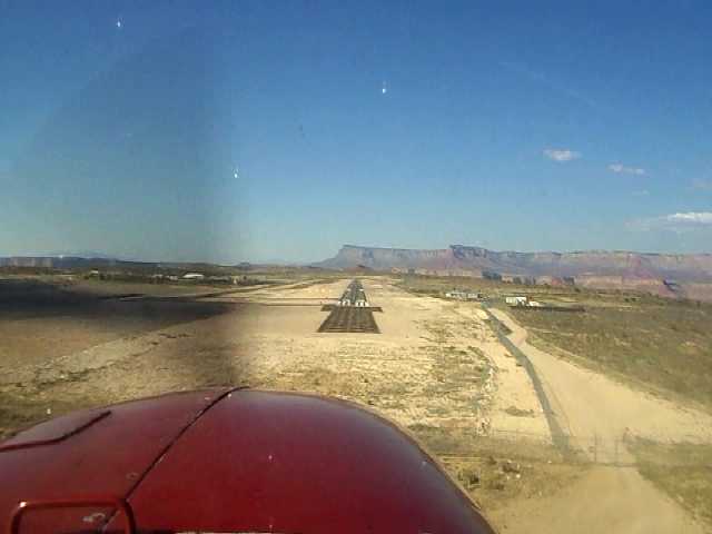
We will climb an additional 300 feet to 5800 feet and fly through a gap between
a couple of cliff peaks.
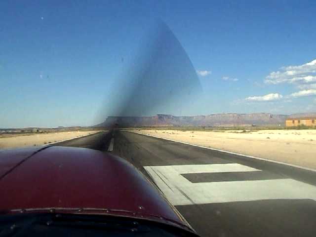
This is
the first still picture capture from a video clip of the Touch and Go Landing on
Runway 35 at 1G4.
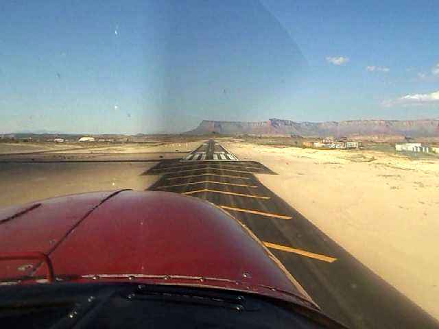
This is a left turn from Base Leg to Final Approach.
I started this turn a little too soon making the bank roll out
nose angled
pointed right of the centerline. I needed the base leg to be just a little longer with a steeper banked
turn to final for proper center line runway alignment. I
sometimes do this on close tight patterns, especially during
low/slow speed
approaches and in unfamiliar airplanes and now at this high density altitude
airport with a cliff edge
in front of me. I guess was being a "little stall gun shy"
or subconsciously adverse to a "cliff edge sharp turn".
Time to stop making the rambling excuses.
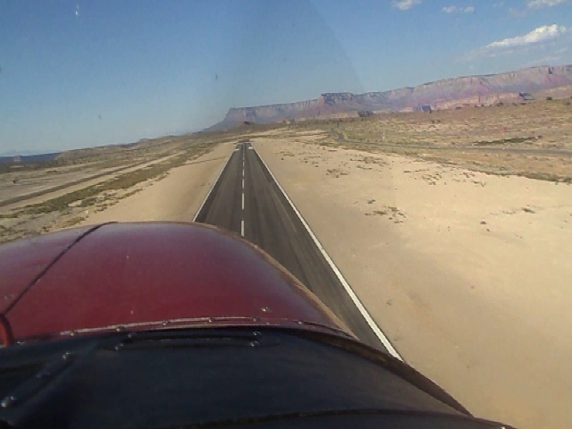
Finally
starting to get lined up with the centerline.
Over the
runway threshold.
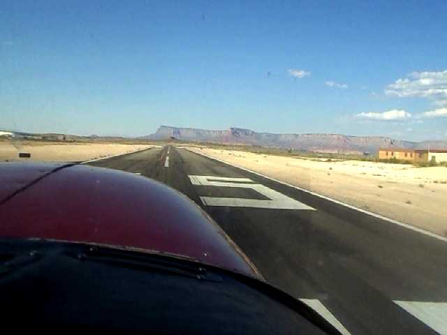
Starting
the landing flare.
Touch down
on the centerline and numbers on Runway 35
Take-off
& climb-out after touch and go landing on Runway 35
Crosswind west turning
climb to 6500 feet back to the Vegas Area
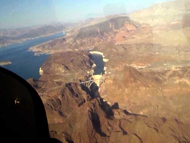
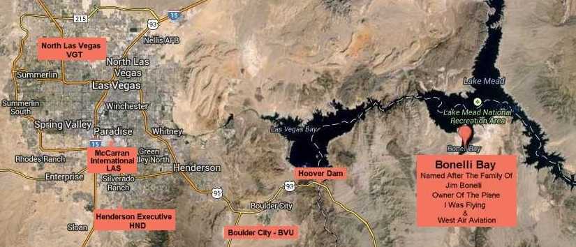
Lake Mead
- Hoover Dam after right turn from Indian Pass
Then onward to over fly Boulder City, Henderson Executive and McCarran International Airports
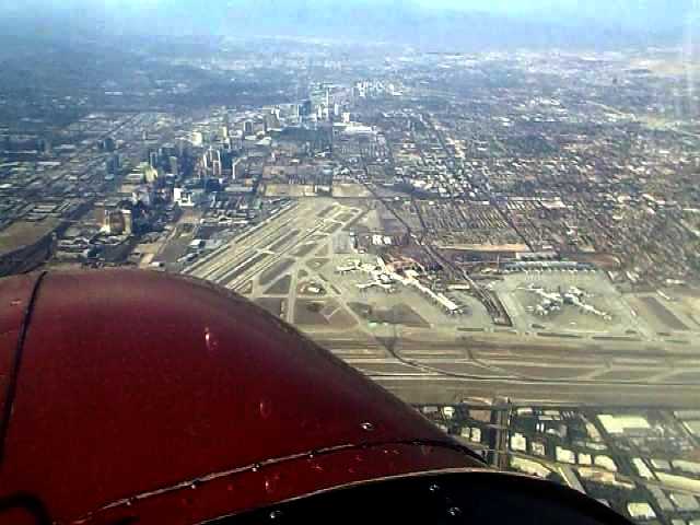
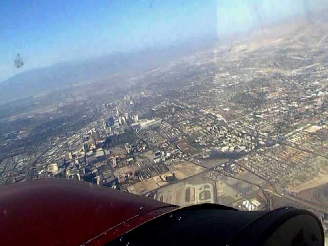
Good view of the entire Las Vegas Strip looking northward.
Over flying
McCarran International Airport Runways 7-25L/R & 1-19L/R - Nose pointed at Mandalay Bay
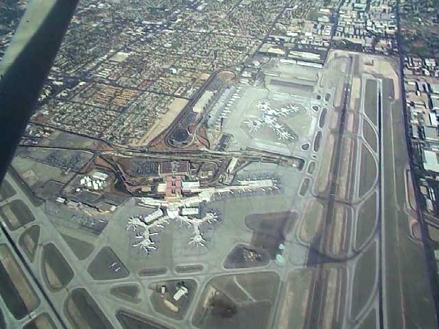
Directly over
both of McCarran's parallel runways looking at the Terminal Building.
McCarran
International Airport
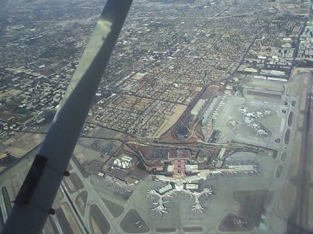
Southeasterly
view of McCarran International Airport
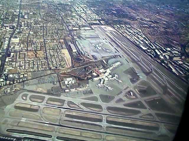
Nice view of the Strip while directly over the
north end of Runway 19L at McCarran International Airport.
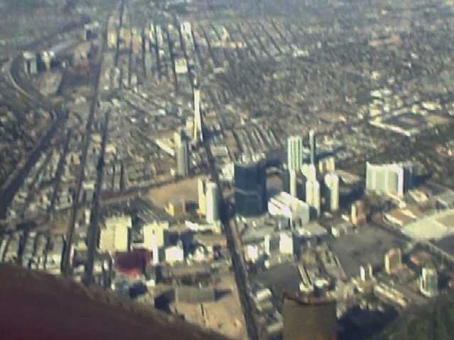
The Wynn
is lower bottom-center-right and Stratosphere is straight ahead
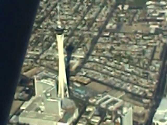
A
closer look of the Stratosphere. Picture focus is diminished when you use the
zoom camera feature.
I had stayed here many times in the past and have done all of their attraction rides.
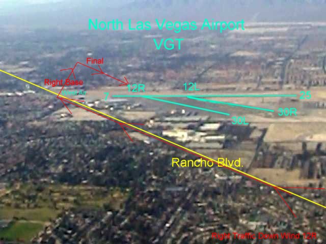
From the
north end the Strip, made a left turn at 3000 feet and followed Rancho Blvd. for
right traffic downwind leg
and landing on Runway 12R.
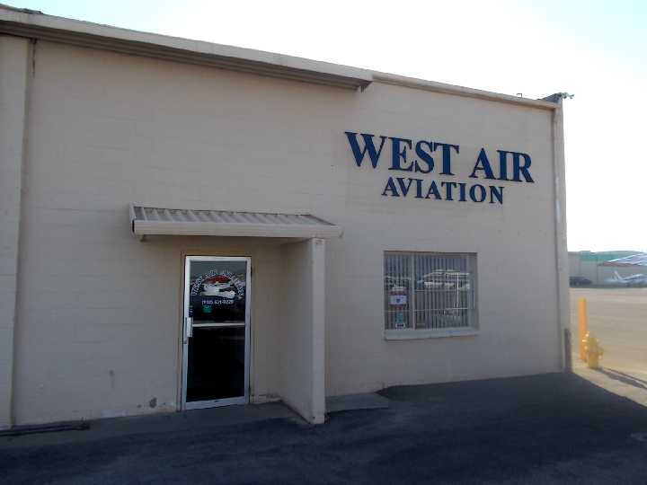
Back to
the West Air Terminal Building.
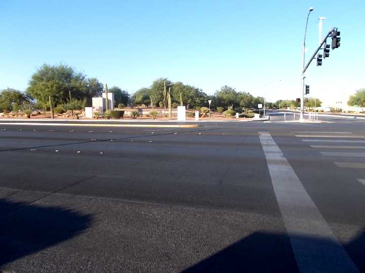
Rancho Blvd. and
Airport Drive intersection that takes you to the North Las Vegas Airport
Terminal and West Air.
The northbound Rancho Blvd. #106 has a bus stop just north of this intersection, saves a walk from the Fiesta stop.
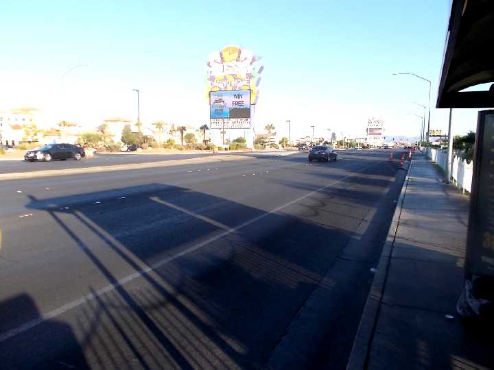
Waiting
for the Southbound Bus #106 across from the Fiesta Casino Hotel. Texas
Station further southeast.
Hoping
the bus will arrive soon and will not encounter the route detours like the Deuce
and the #106 had previously
done during my northbound trip, due to the 4th Annual Fiesta Las Vegas Latino Parade
staging on the Downtown Streets.
Back To Vegas 5
Back
To Vegas Itinerary Menu
Next To Vegas 7
Home
Page Trips
Page
|